Raster and vector tile layers
From v1.19 onwards, NIMBY Rails supports displaying raster and vector tile layers from an external source.

To use these layers in your game, follow the following instructions:
- Open "Map options" in the top right toolbar
- Select Sources.
- Click New Source.
- Copy-paste the URL text from the below table into the URL field, enter an appropriate name, and select the corresponding data format shown in the table below
- Click Create.
*Note: If the create button is greyed out ensure there are no spaces before or after the URL text.
Do not use the "copy link" context menu option from your browser. Select the URL text and copy-paste as if it was plain text.
Do not post any links containing API keys, even if they are your API keys.
Raster tile layer sources
| Description | URL | Data Format | Origin |
|---|---|---|---|
| Google Maps Roads | https://mt1.google.com/vt/lyrs=m&x={x}&y={y}&z={z} | Generic Raster | HTTP |
| Google Maps Satellite | https://mt1.google.com/vt/lyrs=s&x={x}&y={y}&z={z} | Generic Raster | HTTP |
| Google Maps Hybrid (satellite+road) | https://mt1.google.com/vt/lyrs=y&x={x}&y={y}&z={z} | Generic Raster | HTTP |
| ESRI Satellite Imagery | https://server.arcgisonline.com/ArcGIS/rest/services/World_Imagery/MapServer/tile/{z}/{y}/{x}?blankTile=false | Generic Raster | HTTP |
| UK - National Library of Scotland historic maps | See instructions at https://maps.nls.uk/guides/georeferencing/layers-urls/ . Some layers require a MapTiler account. Do not post any MapTiler links containing your API key here. | Generic Raster | HTTP |
| OpenRailwayMap | https://tiles.openrailwaymap.org/standard/{z}/{x}/{y}.png . Note that this version of ORM has severe performance and/or rate limiting issues. Vector sources using in-game data or https://openrailwaymap.app would be better. | Generic Raster | HTTP |
| OpenStreetMap pre-rendered | https://tile.openstreetmap.org/{z}/{x}/{y}.png | Generic Raster | HTTP |
| Mapterhorn hillshade | https://tiles.mapterhorn.com/tilejson.json | Generic Raster | HTTP |
| OpenTopoMap | https://a.tile.opentopomap.org/{z}/{x}/{y}.png . Note that this render doesn't support zoom level 17 and more. | Generic Raster | HTTP |
Examples
Google Layer Examples - Devonport, Tasmania, Australia
-
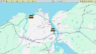 Google Maps Roads
-
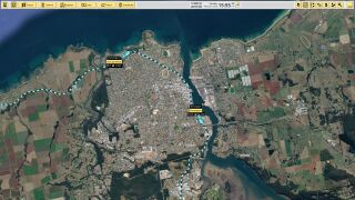 Google Maps Satellite
-
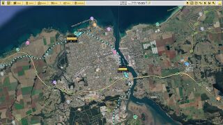 Google Maps Hybrid (satellite+road)


Other Examples - Devonport, Tasmania, Australia
-
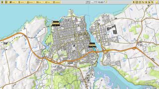 OpenTopoMap
-
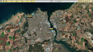 ERSI Satellite Imagery


Other Examples
-
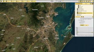 ERSI Satellite Imagery + Open Railway Map
Zoomed out -
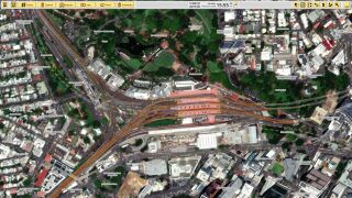 ERSI Satellite Imagery + Open Railway Map
Zoomed In -
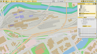 Open Railway Map
Zoomed In - West Melbourne Rail Yard


